
Ukraine’s Rivers Flow to Three Seas — Water Systems, Climate, and Chernozem
Ukraine's river water heads not only to the Black Sea but also to the Sea of Azov and the Baltic Sea. This article sets out the basins of Ukraine's major rivers as recorded in the National Water Cadastre, its natural zones and climate, and the extent and degradation of its chernozem, attaching the issuing body and date to every figure. Even Japan's own public bodies do not agree on the country's area.

Writing about Ukraine’s geography usually involves numbers — area, river length, the share of black soil. Yet which body issued a given number, and when, is rarely stated. This article attaches an issuing body and a point in time to every number.
The Extent of “Ukraine” This Article Describes
In Resolution 68/262 of 27 March 2014, the UN General Assembly affirmed its commitment to Ukraine’s sovereignty and territorial integrity within its internationally recognized borders, and stated that the “referendum” held in the Autonomous Republic of Crimea and the city of Sevastopol on 16 March of that year had no validity. Resolution ES-11/4 of 12 October 2022 likewise declares that the “referenda” of September of that year, and the subsequent attempted annexation of Donetsk, Kherson, Luhansk, and Zaporizhzhia oblasts, have no validity under international law.
What this article means by “Ukraine” is the country within those internationally recognized borders. Which region is currently under whose control is a matter that keeps changing, and this article does not address it. Article 133 of the constitution lists the Autonomous Republic of Crimea, 24 oblasts, and the cities of Kyiv and Sevastopol, which have special status, and Article 134 defines the Autonomous Republic of Crimea as an inseparable constituent part of Ukraine.
Even Japan’s Public Bodies Do Not Agree on the Area
Japan’s Ministry of Foreign Affairs, in its “Ukraine: Basic Data” page (dated 3 September 2026), gives the area as 603,700 square kilometers, about 1.6 times that of Japan. JETRO’s “Overview and Basic Statistics” gives 603,520 square kilometers. The reason for the 180-square-kilometer difference could not be confirmed. As with this site’s basic-facts article, both figures are given here without rounding to a single value.
A “Land of Plains” Divided Into Three Belts
The Internet Encyclopedia of Ukraine (Canadian Institute of Ukrainian Studies, University of Alberta) describes the country, from north to south, as divided into three natural zones: the forest zone of Polissia, the forest-steppe, and the steppe. The entry on Polissia (written by Volodymyr Kubijovyč, Ihor Stebelsky, and Ivan Sydoruk-Pauls) describes it as a broad, flat lowland covered by glacial, meltwater, and river deposits, where the low gradient of rivers and shallow groundwater have produced extensive wetlands, with sandy areas also covering a large share of the land. Present-day Ukrainian Polissia covers roughly 100,000 square kilometers, comprising nearly all of Volyn and Rivne oblasts, about two-thirds of Zhytomyr Oblast, and the northern third of Kyiv Oblast, the entry states.
The entry on the forest-steppe (written by Volodymyr Kubijovyč) describes it as the central belt lying between the northern forest zone and the southern steppe, covering roughly 30 percent of the country. Its northern boundary can be drawn clearly along the line Lviv—Kremenets—Zhytomyr—Kyiv—Nizhyn—Hlukhiv, broadly coinciding with the northern limit of loess (fine wind-deposited sediment) and chernozem. Its southern boundary is unclear, and the entry notes that where it is drawn varies by source. Once a quarter to a third of the region was forested, but today only 11 percent remains so, it states.
The entry on the steppe (written by Ihor Stebelsky) gives Ukraine’s steppe as roughly 240,000 square kilometers, about 40 percent of the country, and divides it into northern, central, and southern subzones. Humus content ranges from 6 to 8 percent in ordinary chernozem in the north, 5 to 6 percent in southern chernozem in the center, 3 to 4 percent in dark chestnut soil, and down to 2 to 3 percent in the chestnut and solonetz soils farthest south. Annual precipitation falls from 450 millimeters near the forest-steppe border to 300 millimeters at Perekop as one moves south, while annual evaporation reaches 900 to 1,000 millimeters, the entry states.
Outside these three belts lie two mountain ranges. The same encyclopedia’s entry “Carpathian Mountains” (written by Volodymyr Kubijovyč; first published in print in 1984) describes the Carpathians as a mountain system arcing roughly 1,500 kilometers from Bratislava to the Iron Gate on the Danube, covering an area of about 200,000 square kilometers, of which 22,500 square kilometers lie within Ukraine. The Ukrainian portion is described as a mountain range of moderate height. The same encyclopedia’s entry on Hoverla identifies it as Ukraine’s highest peak (2,061 meters), part of the Chornohora massif of the Carpathians, and the source of the Prut River.


The entry on the Crimean Mountains (written by Volodymyr Kubijovyč and Edvard Zharsky) describes this range as three parallel ridges running about 150 kilometers from Sevastopol to Feodosia in the southern peninsula, 40 to 50 kilometers wide, descending gently to the north and dropping sharply to the south. The southernmost main ridge, the Yayla, is a high plateau of hard Jurassic limestone with almost no surface water, showing karst features such as sinkholes and caves. Its highest peak is Roman-Kosh (1,545 meters).
The boundaries of these natural zones do not coincide with oblast borders. These entries, moreover, all first appeared in the print Encyclopedia of Ukraine (published 1984–1993), and their figures for cultivated-land ratios and cropping are based on Soviet-era statistics. They cannot be read as current figures.
A Flat Surface Is Not a Flat Subsurface
The same encyclopedia’s entry “Ukrainian Crystalline Shield” (written by Peter Sonnenfeld; first published in print in 1993) describes it as an uplifted mass of Precambrian crystalline rock, running mainly along the right bank of the Dnipro River in a boomerang shape for roughly 1,000 kilometers from the Horyn River in the northwest to the Sea of Azov in the southeast, covering an area of about 200,000 square kilometers. Where rivers have cut deep valleys, as between Dnipro city and Zaporizhzhia, this rock is exposed as cliffs and rapids. The iron ore (jaspilite) of Kryvyi Rih is likewise found in the Lower Proterozoic layers of this shield, the entry states.
To its northeast lies a contrasting structure. The entry “Dnipro-Donets Trough” (first published in print in 1984) describes it as a synclinal structure sandwiched between the Voronezh massif and the shield, 80 to 150 kilometers wide, with sediment reaching a maximum thickness of 11 kilometers near Poltava—Chutove—Krasnohrad, its deepest point. The entry identifies this as Ukraine’s most important oil- and natural-gas-producing area, also yielding rock salt, gypsum, and phosphate rock. Beneath the fields and towns, the geology is built up differently from place to place.
Rivers Flow to Three Seas
The table published by the State Water Resources Agency of Ukraine, in the surface-water section of the National Water Cadastre, shows, for each river, where it flows to and its drainage basin area, broken down into “total” and “within Ukraine.”
| River | Flows into | Basin area, total (km²) | Of which, within Ukraine (km²) |
|---|---|---|---|
| Dnipro | Black Sea | 504,300 | 291,400 |
| Prypiat | Dnipro | 114,300 | 68,366 |
| Desna | Dnipro | 88,900 | 33,820 |
| Dniester | Black Sea | 72,100 | 52,300 |
| Southern Buh | Black Sea | 63,700 | 63,700 |
| Danube | Black Sea | 804,087 | 30,626 |
| Tisza | Danube | 157,186 | 12,777 |
| Prut | Danube | 27,500 | 9,168 |
| Siverskyi Donets | Don | 98,900 | 54,540 |
| Western Buh | Zegrze Reservoir (Narew River) | 39,580 | 10,410 |
| San | Vistula | 16,861 | 2,482 |
The destination is not a single one. The Dnipro, Dniester, Southern Buh, and Danube flow to the Black Sea. The Siverskyi Donets flows into the Don, whose waters head to the Sea of Azov. The Western Buh reaches the Baltic Sea by way of the Narew River, and the San flows directly into the Vistula. The similarly named Southern Buh and Western Buh are different rivers flowing to different seas. The Southern Buh’s basin area of 63,700 square kilometers is entirely within the country and does not cross a border. The Danube’s basin exceeds 800,000 square kilometers, of which only 30,626 square kilometers lie within Ukraine.
On the Danube, the Internet Encyclopedia of Ukraine’s entry “Danube River” (first published in print in 1984) states that the lower 160 kilometers, from the mouth of the Prut River to the Black Sea, forms the border between Ukraine and Romania. In this stretch, the Danube forms a delta and splits into three distributaries, the northernmost of which, the Kiliya arm, runs along nearly 100 kilometers of Ukraine’s border. The same entry lists the Tisza River (from the Carpathians, in Zakarpattia) and the Prut River as rivers within Ukraine’s Danube basin, and names Reni, Izmail, Kiliya, and Vylkove as Ukraine’s Danube river ports.
River lengths cannot be read from the water cadastre’s published PDF, since the relevant column runs off the edge of the page. Table 1 of a 2020 peer-reviewed paper (Didovets et al.) gives the Dnipro at 2,201 kilometers, the Dniester at 1,362 kilometers, the Siverskyi Donets at 1,053 kilometers (of which about 455 kilometers within Ukraine), and the Southern Buh at 806 kilometers, among others. The basin areas in the same table, however, do not match the water cadastre (the Dniester is given as 68,627 versus 72,100). Care is needed when taking length and area from different sources.
The same paper also states that “the Dnipro River’s basin covers about 65 percent of Ukraine’s land area.” But the water cadastre’s within-Ukraine basin area of 291,400 square kilometers is roughly 48 percent of the country’s area of 603,520–603,700 square kilometers. The reason for the discrepancy could not be confirmed, so only the latter figure, whose calculation can be shown, is given here. The same paper also notes that the Dnipro is strongly regulated by a chain of reservoirs and dams built in the 20th century. A large blue expanse on a map is not necessarily a natural lake.
The Dnipro River is also a river that flows in from outside the country. The same encyclopedia’s entry “Dnipro River” (written by Volodymyr Kubijovyč and Ivan Teslia; first published in print in 1984) gives its source as a peat bog at an elevation of 220 meters in the Valdai Hills of Russia, from which it passes through Belarus before entering Ukraine. Its total length is 2,285 kilometers, of which 485 kilometers lie in Russia, 595 kilometers in Belarus, and 1,095 kilometers in Ukraine. This length, too, does not match the 2,201 kilometers given in the paper cited above.
According to the same entry, the shapes of the valley’s left and right banks differ clearly in the stretch between Kyiv and Dnipro city. The right bank stands 100 to 150 meters above the river surface, deeply cut by valleys and gullies and covered in forest, and Kyiv sits atop these “Dnipro hills.” The left bank is low and sandy, rising eastward in broad terraces. By the time this entry was written, however, the main channel from the mouth of the Prypiat River to Kakhovka had already become a chain of dams and reservoirs, with only short stretches of natural river course remaining.
The Lakes Are Small, and the Sea of Azov Is Shallow
The Internet Encyclopedia of Ukraine’s entry “Lakes” (written by Ihor Stebelsky; first published in print in 1993) sums up Ukraine’s lakes as “numerous but small.” The country has more than 3,000 lakes, with a combined surface area of just over 2,000 square kilometers. Only 30 exceed 10 square kilometers, and only 13 exceed 30 square kilometers. Most numerous are the lakes formed by shifts in river courses, which are shallow and small. The exception is the karst lakes of northwestern Polissia: Lake Svityaz has a surface area of 24.2 square kilometers but a maximum depth of 58.4 meters.
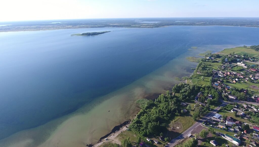

By area, roughly 59 percent of Ukraine’s lake surface lies along the coasts of the Black Sea and the Sea of Azov. The same entry divides these into lagoons formed where shallow sea bays have been closed off, and limans formed where river mouths have been submerged and sealed, both separated from the sea by narrow sandbars. A separate entry, “Estuary” (first published in print in 1984), defines a liman as “a partly closed coastal body of water in which river water is diluted by mixing with seawater.” The Dniester Liman has a surface area of 360 square kilometers but a depth of only 2.5 meters; the Tylihul Liman covers 150 to 170 square kilometers at 21 meters. Bodies of water inside the coastline cannot all be treated as freshwater lakes.
On the Sea of Azov, too, the same encyclopedia’s entry “Azov, Sea of” (written by Volodymyr Kubijovyč; first published in print in 1984) gives concrete figures: an area of 40,000 square kilometers, an average depth of 8 meters, and a maximum depth — even opposite the Kerch Strait, its deepest point — of 14.5 meters. The seabed is flat, covered in sand and shells. Freshwater inflow averages 40.7 cubic kilometers a year, of which 28.5 cubic kilometers comes from the Don River and 11 cubic kilometers from the Kuban River. Because it is shallow and receives so much freshwater from rivers, the difference in temperature and salinity between the surface and the bottom is small, the entry states. The same encyclopedia’s entry “Black Sea” (written by Volodymyr Kubijovyč and Ivan Teslia; first published in print in 1984) gives the Black Sea an average depth of 1,300 meters and a maximum depth of 2,245 meters. The conditions of the water differ entirely from those of the shallow Sea of Azov.
At its western edge lies the Syvash, which the same entry describes as a shallow salt lake separated from the Sea of Azov by the long, narrow Arabat Spit. A separate entry, “Arabat Spit,” gives this sandbar a length of about 100 kilometers and a width ranging from 270 meters to just under 8 kilometers. A body of water that is neither quite sea nor quite land spreads out here.
Meanwhile, much of what now appears on maps as a large blue expanse along the Dnipro River is in fact a reservoir built by people. The same “Lakes” entry states that the Dnipro’s six large reservoirs alone cover more than 7,000 square kilometers of surface water, and that Ukraine’s ponds and reservoirs combined covered 11,730 square kilometers as of January 1986.
The Range of Temperature and Precipitation
The same paper’s summary of the region’s climate gives average January temperatures across most of the country as ranging from −2 to −7.5°C, and average July temperatures from +17.5 to +22°C (citing FAO data from 2015 as its source). Only the southern coast of the Crimean peninsula has a subtropical Mediterranean climate, it states.
Annual precipitation reaches up to 1,600 millimeters in the Carpathian mountains and up to 1,150 millimeters in Crimea; elsewhere it falls from 700–750 millimeters in the northwest to 300–350 millimeters in the southeast (citing Ukraine’s 2013 National Communication on climate change, among other sources). These are all figures the 2020 paper drew from older sources, not new observations.
Future Flow Is “Projection,” Not “Observation”
The same study, having tested six global hydrological models, selected WaterGAP2 and drove it with four bias-corrected ISIMIP2b climate models, comparing projected flow under RCP2.6 and RCP8.5 for 2041–2070 and 2071–2100 against the 1971–2000 baseline.
- RCP2.6: −10% to +6% for the Tisza, Southern Buh, Siverskyi Donets, Desna, and Western Buh. The Dnipro, Dniester, and Prypiat show an average decrease of up to about 20%.
- RCP8.5: Large decreases toward the end of the century in many basins, with the Prypiat, Southern Buh, and Dniester falling by as much as −30%.
- Seasonality: Summer flow decreases in every basin except the Siverskyi Donets. The Desna, Tisza, Southern Buh, and Siverskyi Donets tend toward increased winter flow.
These are future projections based on emissions scenarios; they do not mean a decrease of the same magnitude has already been observed.
Chernozem Is Not Only a Story of “How Much”
A 2019 soil-science paper (Stepan Pozniak, Soil Science Annual, vol. 70, no. 3) records Ukraine’s chernozem (black soil) at about 27.8 million hectares, 8.7 percent of the world’s chernozem area. The paper draws this figure from a separate 2015 source and does not state as of what year it applies. The world’s chernozem totals about 314 million hectares, roughly 2.4 percent of the world’s soil cover, it states.
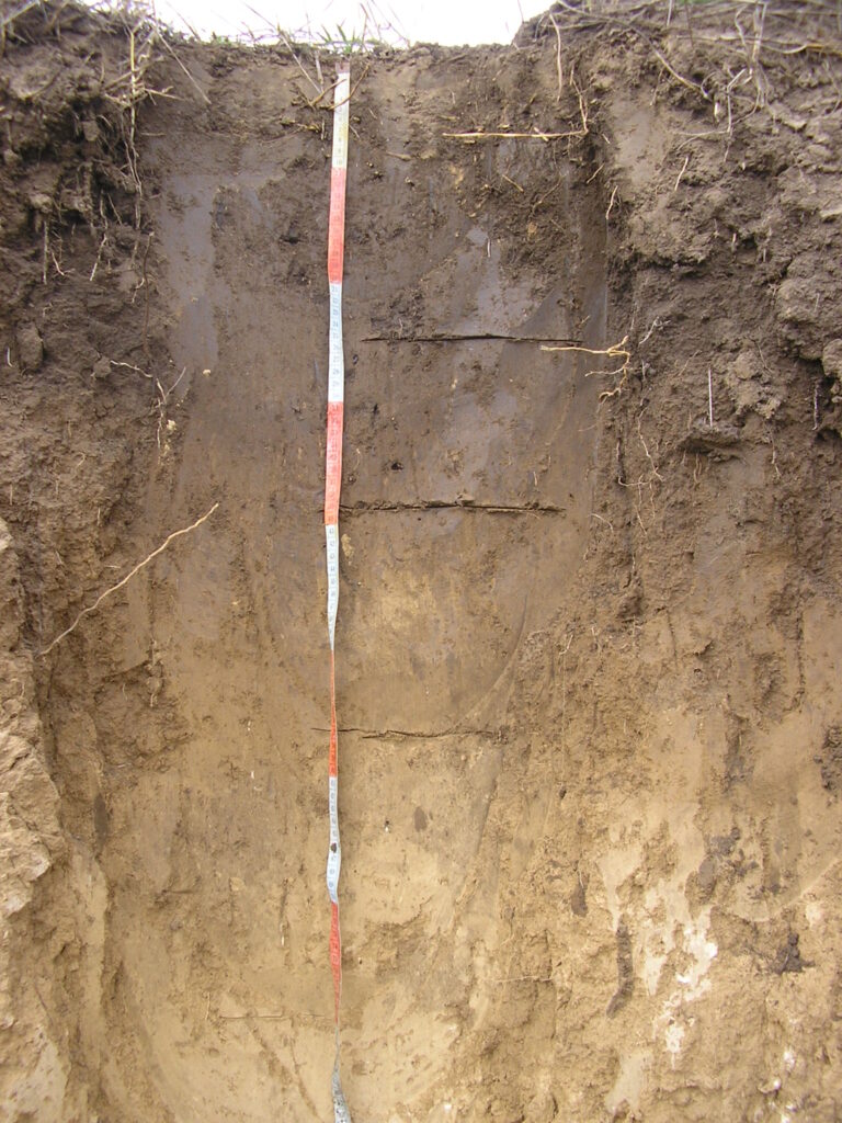

According to the same paper, chernozem covers 67.7 percent of Ukraine’s agricultural land and has been almost entirely converted to cropland. Its formation began roughly 10,000 years ago, and its humus content ranges from 3 to 10 percent or more.
The same paper also gives figures for degradation. In the forest-steppe zone, 85 percent of chernozem has been plowed, and 90 percent in the steppe zone (about 54 percent of soil nationwide has been plowed). Eroded cropland accounts for 30 percent of all cropland, and about 25 percent in the chernozem zone. In the 130 years since Dokuchaev’s research, the loss of topsoil humus has ranged from 21 to 40 percent, or 0.5 to 0.9 tons per hectare. It also cites the example of the Mykhailivska Tsilyna reserve in Sumy Oblast, where the top 30 centimeters of soil has a humus content of 9.5 to 10 percent, compared with 4.5 to 5 percent in cropland of the same soil type.
Article 14 of the constitution designates land as “the principal national wealth” and places it under the special protection of the state. It should be noted that this paper was published in 2019, and the “military soil degradation” it cites refers to the fighting in the Donbas at that time. It does not include the effects of Russia’s full-scale invasion of Ukraine, which began on 24 February 2022.
The frameworks for protection are also not a single thing. Of Ukraine’s eight World Heritage sites, the only natural-heritage one is the “Ancient and Primeval Beech Forests of the Carpathians and Other Regions of Europe,” a transboundary property spanning 93 component parts in 18 countries. Askaniya-Nova, on the other hand, which represents the southern steppe, is not a World Heritage site but a Biosphere Reserve (registered 1984, 33,308 hectares) under UNESCO’s Man and the Biosphere (MAB) Programme. It has been on the World Heritage Tentative List since 1989, but inclusion on the tentative list is a different matter from inscription.
6 June 2023, the Breach of the Kakhovka Dam
The Rapid Environmental Assessment published by the United Nations Environment Programme (UNEP) in October 2023 states that the breach occurred in the early hours of 6 June 2023, and positions the report itself as a preliminary analysis. The assessment distinguishes between “potential impacts,” which remain unconfirmed, and changes that could be measured and observed. It explicitly states that precisely estimating the full scope of impacts on irrigation, drinking water, and industrial supply — including to the Zaporizhzhia Nuclear Power Plant — and the associated health effects, is beyond the scope of this rapid assessment and remains a major concern.
On the cause of the breach, the Ukrainian government has stated that Russian forces, who had controlled the dam and power plant for more than a year, planted explosives and blew it up (statement by Ukraine’s ambassador to the UN at the 9340th meeting of the UN Security Council on 6 June 2023). The international-body sources this article confirmed do not identify a cause. When using maps or satellite imagery, one needs to check when that water surface dates from.
Broad plains, great rivers, black soil. Laid out on their own, a short paragraph is enough. But tracing each number back to its source, the water divides among three seas, the same river’s basin area differs from one source to another, and the richness of the black soil is inseparable from the figures for its degradation.
Sources and article record
Sources and references
- Ukraine: Basic Datadated 3 September 2026 (Reiwa 8); area given as 603,700 square kilometers
Published by Ministry of Foreign Affairs of Japan · Checked: 2026-09-23 - Overview and Basic StatisticsUkraine; area given as 603,520 square kilometers
Published by JETRO (Japan External Trade Organization) · Checked: 2026-09-23 - Resolution 68/262, "Territorial integrity of Ukraine"adopted at the 80th plenary meeting, 27 March 2014
Published by United Nations General Assembly · Checked: 2026-09-23 - Resolution ES-11/4, "Territorial integrity of Ukraine: defending the principles of the Charter of the United Nations"adopted 12 October 2022
Published by United Nations General Assembly · Checked: 2026-09-23 - Constitution of Ukraine, Articles 14, 16, 133, and 134current version as of 1 January 2020, English version by the Verkhovna Rada
Published by Verkhovna Rada of Ukraine Legislation Database (zakon.rada.gov.ua) · Checked: 2026-09-23 - National Water Cadastre (Surface Waters), "Ukraine's Large and Medium Rivers"page published 3 August 2026; the original PDF filename is “Великі та середні річки_з довжиною річок.xlsx”
Published by State Water Resources Agency of Ukraine (Derzhvodahentstvo) · Checked: 2026-09-23 - River Basin Management Plans – Ukraine 2025-2030composition of nine river-basin districts; data as of October 2024; EU co-funded, prepared by Blue Rivers environmental consulting, distributed via the State Water Resources Agency's river-basin-management-plan page
Published by State Water Resources Agency of Ukraine / EU4Environment·EUWI+ · Checked: 2026-09-23 - Didovets, I., Krysanova, V., Hattermann, F.F., Rivas López, M. del R., Snizhko, S., Müller Schmied, H. (2020) Climate change impact on water availability of main river basins in Ukraine. Journal of Hydrology: Regional Studies 32, 100761Table 1 river lengths, Section 2 climate description, Section 4 flow projections
Published by Elsevier (CC BY-NC-ND; text obtained from the Potsdam Institute for Climate Impact Research's public repository) · Checked: 2026-09-23 - Pozniak, S. (2019) Chernozems of Ukraine: past, present and future perspectives. Soil Science Annual 70(3), 193-197area, share of agricultural land, plowing rate, erosion, humus loss
Published by Soil Science Society of Poland (open access) · Checked: 2026-09-23 - Polisiawritten by Volodymyr Kubijovyč, Ihor Stebelsky, Ivan Sydoruk-Pauls; confirms the extent of Polissia and an area of roughly 100,000 square kilometers, glacial, meltwater, and river deposits, and wetlands and sandy areas; first published Encyclopedia of Ukraine vol. 4, 1993
Published by Internet Encyclopedia of Ukraine (Canadian Institute of Ukrainian Studies, University of Alberta) · Checked: 2026-09-23 - Forest-steppewritten by Volodymyr Kubijovyč; confirms the roughly 30% share of the country, the northern boundary line, its coincidence with the northern limit of loess and chernozem, and the decline of forest cover to 11%; first published Encyclopedia of Ukraine vol. 1, 1984
Published by Internet Encyclopedia of Ukraine (Canadian Institute of Ukrainian Studies, University of Alberta) · Checked: 2026-09-23 - Steppewritten by Ihor Stebelsky; confirms roughly 240,000 square kilometers, about 40% of the country, the three subzones and humus content, and the decrease in precipitation and rate of evaporation moving south; first published Encyclopedia of Ukraine vol. 5, 1993
Published by Internet Encyclopedia of Ukraine (Canadian Institute of Ukrainian Studies, University of Alberta) · Checked: 2026-09-23 - Ukrainian Crystalline Shieldwritten by Peter Sonnenfeld; confirms Precambrian crystalline rock, the roughly 1,000-kilometer, 200,000-square-kilometer extent, exposure along river valleys, and Kryvyi Rih's jaspilite iron ore; first published Encyclopedia of Ukraine vol. 5, 1993
Published by Internet Encyclopedia of Ukraine (Canadian Institute of Ukrainian Studies, University of Alberta) · Checked: 2026-09-23 - Dnipro-Donets Troughconfirms its position as a synclinal structure, its 80-150-kilometer width, its 11-kilometer sediment thickness, and its oil, natural gas, rock salt, gypsum, and phosphate rock; no author name shown; first published Encyclopedia of Ukraine vol. 1, 1984
Published by Internet Encyclopedia of Ukraine (Canadian Institute of Ukrainian Studies, University of Alberta) · Checked: 2026-09-23 - Lakeswritten by Ihor Stebelsky; confirms more than 3,000 lakes with a combined surface area of just over 2,000 square kilometers, the numbers exceeding 10 and 30 square kilometers, Lake Svityaz's area and depth, coastal lakes as roughly 59% of lake surface area, the area and depth of the Dniester Liman and the Tylihul Liman, the Dnipro's six large reservoirs exceeding 7,000 square kilometers, and the combined area of ponds and reservoirs of 11,730 square kilometers as of January 1986; first published Encyclopedia of Ukraine vol. 3, 1993
Published by Internet Encyclopedia of Ukraine (Canadian Institute of Ukrainian Studies, University of Alberta) · Checked: 2026-09-23 - Estuarydefinition of a liman; first published Encyclopedia of Ukraine vol. 1, 1984; the same encyclopedia's entry "Limans" is a cross-reference to this entry and to "Lakes"
Published by Internet Encyclopedia of Ukraine (Canadian Institute of Ukrainian Studies, University of Alberta) · Checked: 2026-09-23 - Azov, Sea ofwritten by Volodymyr Kubijovyč; confirms an area of 40,000 square kilometers, an average depth of 8 meters, a maximum depth of 14.5 meters, seabed character, the 40.7-cubic-kilometer freshwater inflow breakdown, and the Syvash and the Arabat Spit; first published Encyclopedia of Ukraine vol. 1, 1984
Published by Internet Encyclopedia of Ukraine (Canadian Institute of Ukrainian Studies, University of Alberta) · Checked: 2026-09-23 - Arabat Spitconfirms a length of about 100 kilometers, a width of 270 meters to just under 8 kilometers, and that it separates the Syvash from the Sea of Azov; no author name or first-publication date shown
Published by Internet Encyclopedia of Ukraine (Canadian Institute of Ukrainian Studies, University of Alberta) · Checked: 2026-09-23 - Rapid Environmental Assessment of Kakhovka Dam Breach, Ukraine, 2023October 2023; report summary
Published by United Nations Environment Programme (UNEP) · Checked: 2026-09-23 - Ancient and Primeval Beech Forests of the Carpathians and Other Regions of Europestatement of Outstanding Universal Value; 93 component parts in 18 countries; criterion (ix)
Published by UNESCO World Heritage Centre · Checked: 2026-09-23 - Ukraine — World Heritage properties inscribed on the World Heritage List, and the Tentative List
Published by UNESCO World Heritage Centre · Checked: 2026-09-23 - Askaniya-Nova Biosphere Reserveregistered 1984; 33,308 hectares
Published by UNESCO Man and the Biosphere (MAB) Programme · Checked: 2026-09-23 - Hoverliaconfirms Ukraine's highest peak at 2,061 meters, the Chornohora massif, and that it is the source of the Prut River; first published Encyclopedia of Ukraine vol. 2, 1988
Published by Internet Encyclopedia of Ukraine (Canadian Institute of Ukrainian Studies, University of Alberta) · Checked: 2026-09-23 - Crimean Mountainswritten by Volodymyr Kubijovyč, Edvard Zharsky; confirms the Yayla's highest peak, Roman-Kosh, at 1,545 meters; first published Encyclopedia of Ukraine vol. 1, 1984
Published by Internet Encyclopedia of Ukraine (Canadian Institute of Ukrainian Studies, University of Alberta) · Checked: 2026-09-23 - Carpathian Mountainswritten by Volodymyr Kubijovyč; confirms the roughly 1,500-kilometer arc and roughly 200,000-square-kilometer area, of which 22,500 square kilometers lie within Ukraine, and the description as a mountain range of moderate height; first published Encyclopedia of Ukraine vol. 1, 1984
Published by Internet Encyclopedia of Ukraine (Canadian Institute of Ukrainian Studies, University of Alberta) · Checked: 2026-09-23 - Danube Riverconfirms the 160-kilometer border stretch from the mouth of the Prut River to the Black Sea, the delta's three distributaries and the Kiliya arm, the Ukrainian tributaries the Tisza and Prut rivers, and the ports; no author name shown; first published Encyclopedia of Ukraine vol. 1, 1984
Published by Internet Encyclopedia of Ukraine (Canadian Institute of Ukrainian Studies, University of Alberta) · Checked: 2026-09-23 - Dnipro Riverwritten by Volodymyr Kubijovyč, Ivan Teslia; confirms the source in the Valdai Hills, the total length of 2,285 kilometers and the breakdown by country, the difference between the right and left banks between Kyiv and Dnipro city, and the chain of reservoirs and the remaining stretches of natural channel; first published Encyclopedia of Ukraine vol. 1, 1984
Published by Internet Encyclopedia of Ukraine (Canadian Institute of Ukrainian Studies, University of Alberta) · Checked: 2026-09-23 - Black Seawritten by Volodymyr Kubijovyč, Ivan Teslia; confirms an average depth of 1,300 meters and a maximum depth of 2,245 meters; first published Encyclopedia of Ukraine vol. 1, 1984
Published by Internet Encyclopedia of Ukraine (Canadian Institute of Ukrainian Studies, University of Alberta) · Checked: 2026-09-23 - S/PV.9340. Security Council, 9340th meeting, 6 June 2023confirms, from the PDF text, the statement of Ukraine's UN ambassador Kyslytsya: "Russia has been controlling the dam and the entire Kakhovka hydroelectric power plant for more than a year. ... It was mined by the Russian occupiers, and they blew it up." — the basis for the Ukrainian government's position on the cause of the Kakhovka dam breach
Published by United Nations Security Council · Checked: 2026-09-23
Corrections and updates
- Added statements on the three natural zones (Polissia, forest-steppe, and steppe), the Ukrainian Crystalline Shield and the Dnipro-Donets Trough, lakes and limans, and the depth of the Sea of Azov, from entries in the Internet Encyclopedia of Ukraine (Canadian Institute of Ukrainian Studies, University of Alberta).
- Added the elevations of Mount Hoverla and Roman-Kosh, from statements in the Internet Encyclopedia of Ukraine.
- Added statements on the topography of the Carpathian Mountains and the Crimean Mountains, the Dnipro River's source, length, and the difference between its two banks, the Danube's lower border stretch and delta, and the depth of the Black Sea, from entries in the Internet Encyclopedia of Ukraine (Canadian Institute of Ukrainian Studies, University of Alberta). Also added, to "what this article could not confirm," the fact that river lengths do not agree between sources.
- On the cause of the Kakhovka Dam breach, added the Ukrainian government's position that it was caused by an explosion set by Russian forces, citing a statement at the UN Security Council. Also corrected a passage that could be read as saying the San River reaches the Vistula by way of the Narew River, to state that it flows directly into the Vistula.
If you find an error in this article, please tell us via Corrections. Once we have checked it, we will record in the article what was corrected and why.
Related articles
-
Ukraine’s Anti-Corruption Bodies, and the Nine Days in July 2025 When Their Independence Wavered
Ukraine divides anti-corruption work among several bodies: prevention by the National Agency on Corruption Prevention, investigation by the National Anti-Corruption Bureau (NABU), prosecution by the Specialized Anti-Corruption Prosecutor's Office (SAPO), and trial by the High Anti-Corruption Court. A law of 22 July 2025 placed NABU and SAPO under the authority of the Prosecutor General; a law nine days later restored their independence. Drawing on the text of both laws and the European Commission's assessment, this article explains what changed and what challenges remain.
-
The “Father of Futurism” Lands at Tsuruga, 1920: Painter Davyd Burliuk’s Two Years in Japan
In October 1920, painter Davyd Burliuk, born in Kharkiv Province, arrived by ship at Tsuruga. From "the First Exhibition of Russian Painting in Japan" in Tokyo to life on Ogasawara and a co-authored book with young Japanese painters, this article traces his roughly two years in Japan through research into contemporary records and encyclopedias.
-
How Many Died in the Holodomor? Why Estimates Range from 2.6 Million to 5 Million
The Holodomor was a man-made famine in Soviet Ukraine in 1932–33. The death toll varies depending on who is counting: from the roughly 3.94 million excess deaths in a 2015 demographic paper, to lower estimates, to higher figures. This article sums up Ukraine's 2006 law, recognition by various countries' parliaments, and the Japanese government's Diet answer that it is “not in a position to assess” the events—attributing who said what.