
In Ukraine’s Protected Areas: Steppe That Was Never Plowed, and 28 Lakes
In southern Ukraine, steppe that has never been plowed survives; at the western edge, in the Carpathians, old-growth beech forest remains; and in the northwest, in Polissia, lakes and peat wetlands endure. The nature reserves at the heart of these areas were established not as tourist sites but as places of research. Drawing on the records of biosphere reserves and Ramsar wetland sites, this article traces what is being protected, and what is studied there.

Ukraine’s territory is divided, from north to south, into three belts — the forest zone of Polissia, forest-steppe, and steppe — with the Carpathian Mountains to the west. That broad terrain and river system are covered in this article on rivers, climate, and chernozem. As that article showed, most of the chernozem of the forest-steppe and steppe has already been plowed. This article looks instead at the small portion of “original” landscape that remains. What is protected, what lives there, and what the people working in these reserves keep measuring.
A reserve was, first of all, a place of research
The entry on “Nature preserves” (written by Philip Pryde and Ihor Stebelsky, revised 2009) in the Internet Encyclopedia of Ukraine (IEU), compiled by the University of Alberta’s Canadian Institute of Ukrainian Studies (CIUS), explains Ukraine’s system of protected areas as follows.
At its center is the nature reserve called a “zapovidnyk” (заповідник), whose main role, the entry states, is to function as a research facility. It preserves a representative portion of a particular landscape or ecosystem — steppe, river delta, forest — and is sometimes called a “nature standard” (etalon). A tourism role is barely envisioned for it; that is assigned instead to national nature parks.
Around this, several smaller kinds of area overlap. A “zakaznyk” (заказник) protects only specific plants or animals (the entry counts 2,709 as of 2007); a “nature monument” protects an individual feature such as a cave or waterfall (3,078 as of the same year). Per the same entry, as of 2007 the combined area of reserves, parks and the like was about 2.8 million hectares, roughly 4.7% of the country’s territory. All of these figures are nearly 20 years old, not current.
Steppe — Askania-Nova
Askania-Nova, in Kherson oblast in southern Ukraine, is a biosphere reserve under UNESCO’s Man and the Biosphere (MAB) Programme. UNESCO’s page gives 1984 as the year of designation and 33,308 hectares as the area, placing it 60 kilometers southeast of the town of Kakhovka, near the Black Sea. It lists grassland dominated by feather grass (Stipa) and fescue (Festuca) as the main habitat.
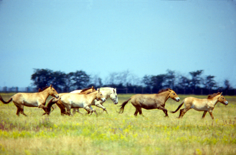
Per the IEU’s entry “Askaniia-Nova Biosphere Reserve” (written by Marko Robert Stech and Edvard Zharsky, revised 2025), it began in 1874 as a zoo the Prussian-descended settler Friedrich Falz-Fein opened on his father’s land. In 1898 it opened to the public as a facility combining an unplowed-steppe reserve, a zoo, and an arboretum. The entry states that Falz-Fein was among those who led the capture of wild Przewalski’s horses in Mongolia, and that the wild Przewalski’s horses alive in the world today are, in effect, descendants of the herd preserved here. Of the reserve’s area, 11,054 hectares is steppe that has never been plowed.
The same entry also mentions its role as a stopover for birds. The Chapli Depression (4 by 6 kilometers) within the reserve is a Ramsar-registered wetland, where large flocks of cranes, greylag geese, and white-fronted geese stop during migration. It states that about 270 species of wild bird have been recorded across the reserve as a whole.
The year of biosphere-reserve designation, however, is not consistent: UNESCO’s page gives 1984, while the IEU gives 1985. The IEU also states that this reserve lies in territory currently occupied by the Russian Federation, and that since 20 March 2023 the entire reserve has been under the control of the occupation authorities.
Mountains — the Carpathian Biosphere Reserve
The Carpathian Biosphere Reserve, in Zakarpattia oblast in the west, joined UNESCO’s network of biosphere reserves in 1992. UNESCO’s page gives its area as 65,828 hectares, and explains that it covers every natural zone of the southern slope of the Ukrainian Carpathians, from lowlands at 180 meters up to the alpine zone at 2,061 meters (Mount Hoverla). It records 3,022 plant species (1,353 of them vascular plants) and 315 vertebrate species, and states that populations of large carnivores such as wolves, lynx, and brown bears are well preserved.
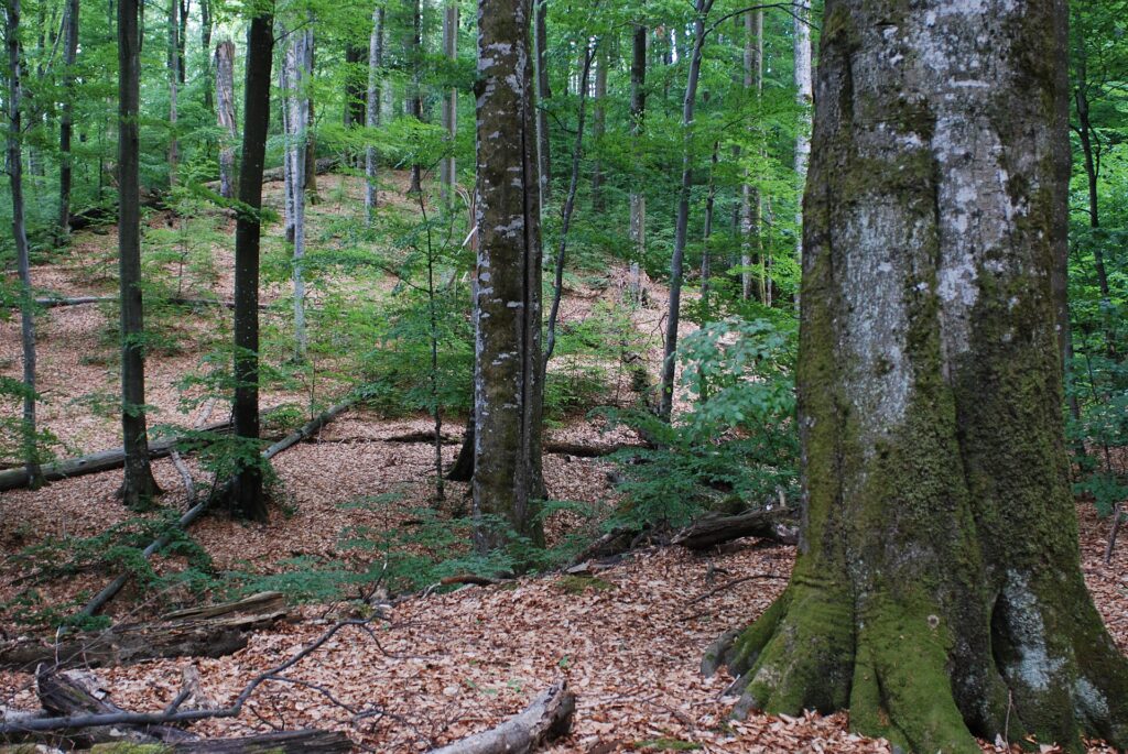
The IEU’s entry of the same name (written by Volodymyr Kricsfalusy, 2008) describes the reserve as a cluster of six separate mountain massifs. One of them, the Uholka–Shyrokyi Luh massif (15,580 hectares), is known as the largest stretch of old-growth beech forest in Europe, and the “Valley of Narcissi” near Khust (257 hectares) is an area protecting a large stand of narrow-leaved daffodils said to have survived since the last ice age. The area the IEU gives for 2008, 53,630 hectares, differs from UNESCO’s current figure. Whether the boundaries changed or the counting method differs cannot be determined from either source.

This reserve is not separated from human life. UNESCO’s page states that although most local residents live outside the reserve, most land use takes place within it — particularly grazing cattle and sheep on the mountain pastures called “polonyna,” where shepherds jointly watch the herds through the summer. UNESCO writes that guaranteed rights to use the pastures and to access them are critically important to residents, while also noting that illegal logging occurs.
Wetlands — the lakes and peat of Polissia
Per the IEU’s entry “Wetlands” (written by Ihor Stebelsky; first published 1993), Ukraine’s wetlands cover about 1 million hectares, 1.7% of the country, concentrated mostly along both banks of the Pripyat River, especially in the western oblasts of Volyn and Rivne. The entry notes that draining wetlands was long regarded as “sound economic policy,” and that drained farmland exceeded 3 million hectares by 1987. As a result, spring flooding increased and summer flow decreased on rivers such as the Pripyat. Wetlands act as a sponge regulating river flow, filter pollution, and serve as a refuge for wildlife — which is why, the entry concludes, they are now seen as something to conserve.
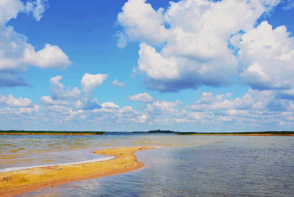
At its northwestern edge, near the border with Poland and Belarus, lies Shatsk. It became a national nature park in 1983 (IEU), and in 2002 was designated the “Shatskyi” UNESCO biosphere reserve. UNESCO’s page gives its area as 75,075 hectares, and notes that the 28 lakes here form one of Europe’s foremost groups of lakes, with Lake Svityaz the country’s deepest natural lake at 58.4 meters. It lies where two major migration routes cross, and tens of thousands of waterbirds use the lakes each spring and autumn. Western Polissia, it states, is a core habitat for the aquatic warbler (Acrocephalus paludicola), a globally threatened relative of the reed warbler.

| Biosphere reserve | Main ecosystem | Year designated | Area (hectares) |
|---|---|---|---|
| Askania-Nova | Feather-grass steppe | 1984 | 33,308 |
| Carpathian | Mountain forest and alpine grassland | 1992 | 65,828 |
| Danube | Danube delta and floodplain | 1998 | 49,806 |
| Black Sea | Sandy areas, bays, and islands | 1998 | 89,129 |
| Shatskyi | Lakes, peat wetlands, and pine forest | 2002 | 75,075 |
| Desnianskyi | Desna River floodplain and pine forest | 2009 | 70,748 |
Ramsar wetlands, and after the full-scale invasion
Ukraine’s Ministry of Environmental Protection and Natural Resources, on a page for World Wetlands Day 2025, states that 50 sites in the country are on the Ramsar Convention’s list of “Wetlands of International Importance.”
On the same page, the ministry gives its own analysis of the impact of the occupation since 2014 and Russia’s full-scale invasion of Ukraine, which began on 24 February 2022, as follows. Of the 50 sites, 48 have been affected by hostilities or their economic effects, and 31 have suffered damage from fighting, shelling, mine-laying, or the training and movement of Russian forces. Three of these were caused by what the ministry calls the “blowing up” of the Kakhovka Dam in June 2023: the “Dnipro River Delta” was completely flooded, with part of it damaged, one other site dried up completely, and another partly. The ministry also states that in occupied wetland areas, conservation work has either stopped or is being carried out in ways that violate Ukrainian law and international agreements.
This is an announcement from a Ukrainian government body, not the result of an independent, on-the-ground verification of the extent of damage to individual wetlands. Many of these sites are also difficult to survey on the ground.
What is studied at these reserves
The work of a reserve lies not in fencing land off, but in continuous measurement. UNESCO’s page on Shatskyi states that universities and research institutes in Lviv, Lutsk, and Kyiv maintain field stations here, carrying out long-term research on topography, hydrology, aquatic life, soil, vegetation, ecology, and conservation management. The reserve itself, it states, also works to maintain lake water levels, raise the surrounding groundwater level, and restore wetland vegetation. Lakes and wetlands supply drinking water, peatlands store carbon, and both ease flooding — this research also exists to confirm that these functions are being maintained.
In the Carpathians, the same mountain pastures are both habitat for rare plants and grazing land for shepherds. It is not a matter of excluding one or the other, which is why UNESCO’s description devotes so much space to residents’ rights of use. The value of Askania-Nova’s steppe never having been plowed only becomes clear by comparison with the surrounding farmland.
Understanding Ukraine’s nature is not only a matter of area and species counts. Which grassland survived unplowed, and why; which wetland escaped being drained, and why; who is measuring what there — the record kept by these reserves is itself an answer to those questions.
Sources and article record
Sources and references
- Nature preserveswritten by Philip Pryde and Ihor Stebelsky. Revised 2009. The categories of protected area, the role of a zapovidnyk and the “nature standard,” 2,709 zakaznyky and 3,078 nature monuments as of 2007, a combined total of about 2.8 million hectares / roughly 4.7% of the country
Published by Internet Encyclopedia of Ukraine (Canadian Institute of Ukrainian Studies, University of Alberta) · Checked: 2026-09-23 - Askaniia-Nova Biosphere Reservewritten by Marko Robert Stech and Edvard Zharsky. Revised 2025. The 1874 zoo, the 1898 public opening, Przewalski's horses, 11,054 hectares of virgin steppe, about 270 bird species, the Chapli Depression, the 1985 designation, control under occupation
Published by Internet Encyclopedia of Ukraine (Canadian Institute of Ukrainian Studies, University of Alberta) · Checked: 2026-09-23 - Carpathian Biosphere Reservewritten by Volodymyr Kricsfalusy. 2008. The six mountain massifs, 53,630 hectares, the Uholka–Shyrokyi Luh massif, the Valley of Narcissi
Published by Internet Encyclopedia of Ukraine (Canadian Institute of Ukrainian Studies, University of Alberta) · Checked: 2026-09-23 - Wetlandswritten by Ihor Stebelsky. First published in Encyclopedia of Ukraine, vol. 5, 1993. About 1 million hectares of wetlands / 1.7%, the distribution across Polissia, over 3 million hectares of drained farmland by 1987, the functions of wetlands
Published by Internet Encyclopedia of Ukraine (Canadian Institute of Ukrainian Studies, University of Alberta) · Checked: 2026-09-23 - Shatsk National Nature Parkrevised 2014. Established 1983, northwestern Volyn oblast
Published by Internet Encyclopedia of Ukraine (Canadian Institute of Ukrainian Studies, University of Alberta) · Checked: 2026-09-23 - Black Sea Biosphere Reserverevised 2009. Designated a biosphere reserve in 1998, an area of 89,129 hectares as of 2007, of which 74,971 hectares is water
Published by Internet Encyclopedia of Ukraine (Canadian Institute of Ukrainian Studies, University of Alberta) · Checked: 2026-09-23 - Askaniya-Novayear designated 1984, area 33,308 hectares, location, main vegetation
Published by UNESCO Man and the Biosphere (MAB) Programme · Checked: 2026-09-23 - Carpathianyear designated 1992, area 65,828 hectares, elevation 180–2,061 meters, 3,022 plant species / 315 vertebrate species, large carnivores, grazing and use rights, illegal logging
Published by UNESCO Man and the Biosphere (MAB) Programme · Checked: 2026-09-23 - Shatskyiyear designated 2002, area 75,075 hectares, 28 lakes, Lake Svityaz at 58.4 meters, migration routes, Acrocephalus paludicola, long-term university/institute research, water-level and wetland restoration work
Published by UNESCO Man and the Biosphere (MAB) Programme · Checked: 2026-09-23 - Dunaiskyyear designated 1998, area 49,806 hectares, delta vegetation
Published by UNESCO Man and the Biosphere (MAB) Programme · Checked: 2026-09-23 - Desnianskyiyear designated 2009, area 70,748 hectares, the Desna River floodplain and pine forest
Published by UNESCO Man and the Biosphere (MAB) Programme · Checked: 2026-09-23 - Всесвітній день водно-болотних угідьWorld Wetlands Day. The 2025 theme, the 50 Ramsar wetland sites, the ministry's own analysis of the impact of the full-scale invasion and occupation
Published by Ministry of Environmental Protection and Natural Resources of Ukraine (Міністерство захисту довкілля та природних ресурсів України) · Checked: 2026-09-23
If you find an error in this article, please tell us via Corrections. Once we have checked it, we will record in the article what was corrected and why.
Related articles
-
Some Borrow at 3%, Others at 7%: Ukraine’s Mortgage Program “ЄОселя”
Ukraine's government mortgage program “ЄОселя” began in October 2022, and 28,579 loans had been disbursed by September 15, 2026. Service members, medical workers, teachers, researchers, and, from July 2026, war veterans, pay 3% a year; internally displaced people and other citizens pay 7% a year. Both the borrower and the home being bought must meet conditions on citizenship, floor area, and the building's age.
-
“Ukrainian Film” Means Five Different Things — Country of Production, Setting, and Who Made It
The phrase “Ukrainian film” refers to at least five different things: a film produced in Ukraine, a film with Ukraine as one of its co-producing countries, a film made by another country but set in Ukraine, a film made abroad by a filmmaker from Ukraine, and a film made in the former Soviet era. Using films whose stated country of production can be checked, this article shows how to sort them out and how to check.
-
From a Reconstruction Registry to a Public Investment System: Ukraine’s Digital System “DREAM”
DREAM, the Ukrainian government's digital system for registering and publishing reconstruction and public-works projects, began in 2022 as a pilot project and, under a July 2026 government decision, became the mechanism for managing the country's entire public investment. This article looks at the underlying decisions, the bodies that manage it, the stages a project goes through, and how to read the 14,611 projects listed, based on the legal texts and public statements as of September 2026.